Case Studies

Maps that changed how someone understood their land.

Three case studies in geospatial analysis, environmental cartography and web mapping, with methodology, data sources and outcomes.

Chico Mendes Reserve
Land-Cover Atlas

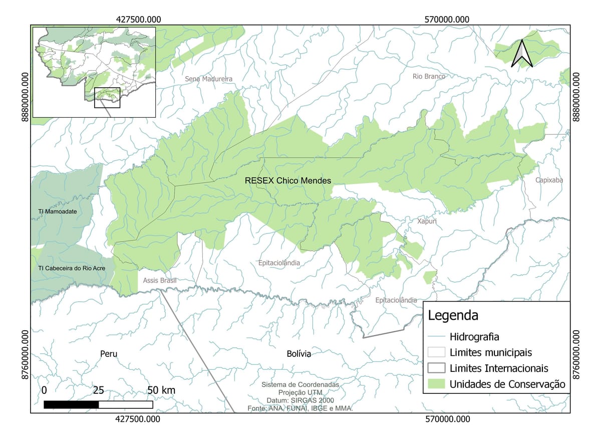
Reference plate (left) and 1985 land-cover classification (right). QGIS · MapBiomas Coll. 8 · SIRGAS 2000 / UTM · A3 print-ready.

Thirty-seven years of land-cover change inside the Chico Mendes Extractive Reserve had never been visualised as a structured temporal atlas. The reserve, established in 1990 after the assassination of Chico Mendes, sits at the Brazil–Peru–Bolivia triple frontier, one of the most biodiverse and politically sensitive landscapes in the Amazon. Understanding how illegal deforestation, road construction and agricultural expansion had changed the reserve's internal land cover required integrating multiple years of satellite-derived data into a legible, publication-ready narrative.

  • MapBiomas Collection 8, land-cover classifications, 1985–2022
  • Google Earth Engine, cloud computing and band analysis
  • ANA, FUNAI, IBGE, MMA, hydrography, indigenous territories, administrative boundaries
  • PRODES, deforestation annual increments as verification layer
  1. Downloaded MapBiomas Collection 8 rasters for the Chico Mendes RESEX boundary for six time steps: 1985, 1995, 2005, 2015, 2020, 2022.
  2. Reclassified land-cover classes to a five-category schema: native forest, secondary vegetation, agriculture/pasture, water bodies, other.
  3. Computed area statistics per class per year in Google Earth Engine.
  4. Designed cartographic plates in QGIS with a consistent colour schema across all time steps.
  5. Prepared a scrolling narrative atlas, pairing map frames with interpretive text.
  6. Verified 2020–2022 change with PRODES annual deforestation polygons.
  • The RESEX interior held remarkably well between 1985 and 2005, the reserve boundary functioned as an effective deforestation barrier.
  • Between 2005 and 2022, the BR-364 corridor and secondary roads east of the reserve generated "fish-bone" deforestation patterns reaching the reserve's buffer zone.
  • The eastern flank shows the first signs of internal agricultural encroachment by 2022.
  • Secondary vegetation recovery is visible in some previously cleared areas, suggesting partial agroextractive management.
  • 6 cartographic plates, QGIS, print-ready A3, SIRGAS 2000 / UTM
  • Statistical summary table, area per class per year
  • Scrolling web atlas with interactive frame progression
  • Source data package with methodology notes
QGIS Google Earth Engine MapBiomas PRODES ArcGIS Pro

Submitted as the undergraduate monograph at UFAC (2024). The atlas became the first systematic temporal analysis of Chico Mendes RESEX land cover at this resolution. The scrolling web version is embedded in the Forestana portfolio,see it in action on the home page.

Kaçmaz Arsa:
Interactive Land Investment Map

Illustration of the interactive map interface, parcel outlines, zone overlays, popup metadata panels and amenity proximity markers. Mapbox GL JS · custom editorial basemap style.

A Turkish land-investment company needed a public-facing property map that could present land parcels, zoning overlays and surrounding amenities to international buyers, but existing GIS exports looked technical, unapproachable and unsuitable for a commercial audience. The map needed to work in two languages, feel like an editorial brochure, and be fast on mobile.

  • Client-provided parcel boundaries, geodata in multiple formats, cleaned and unified
  • OpenStreetMap, amenities and road network
  • Turkish land registry data, zoning classification
  • Satellite basemaps via Mapbox
  1. Received client parcel data in inconsistent formats; cleaned and unified in QGIS.
  2. Designed a custom Mapbox GL style to match the client's brand palette, replacing the default map aesthetic with an editorial, warm-toned cartographic style.
  3. Built Turf.js-powered proximity analysis to calculate and display distances to amenities (schools, roads, hospitals).
  4. Implemented property hover states, popup panels and a filter sidebar.
  5. Delivered as a static web application embedded in the client's existing site.
  • Interactive Mapbox GL web map with custom cartographic style
  • Property popup panels with parcel metadata
  • Amenity proximity analysis using Turf.js
  • Filter sidebar, by zone type and area range
  • Embedded integration for kacmazarsa.com
Mapbox GL Turf.js QGIS HTML / CSS / JS

Live at kacmazarsa.com/listings. The map replaced a static PDF parcel list and became the primary property-discovery tool on the site. Client reported improved engagement from international buyers comparing parcels before site visits.

ACS Consultorias:
Geotechnology Training for Amazon Communities

Illustration of the training methodology, participants produce real territorial maps using GPS field data, QGIS and MapBiomas during the workshop sessions.

Across the Amazon, rural producers, community leaders and municipal extension workers lacked the geospatial skills to produce or interpret the territorial maps that CAR/PRA environmental compliance requires. ACS Consultorias, founded by Ana Clara Santos Venâncio in 2021, was created to close this gap, delivering practical geotechnology training that produces usable outputs, not just conceptual understanding.

Designed a modular training curriculum covering QGIS basics, GPS field data collection, MapBiomas interpretation, Google Earth Engine for non-coders, and compliance documentation workflows.

Delivered workshops to diverse audiences: rural producers in the BR-364 corridor, indigenous community monitors (Nawa, Nukini, Cabeceira do Rio Acre), municipal environmental officers, and conservation project teams.

Paired training with live deliverable production, participants left each session with a real map of their own territory.

  • Training curriculum,5 modules, modular, replicable
  • Participant workbooks
  • QGIS project templates pre-loaded with regional data
  • Follow-up support for organisations applying the skills
QGIS Google Earth Engine MapBiomas Avenza GPS devices Field data apps

More than 400 people trained across multiple programmes. Several community organisations now maintain their own QGIS capacity and produce territorial maps independently. The training methodology informed the development of the Envreg service model.

Work together

Have a territory, dataset or environmental story that needs to become clear?

Whether it's a conservation monitoring report, a compliance map, a web-based territorial dashboard, or a training programme, let's scope the right approach.